|
Shenandoah National Park - North section
|
| Trail |
Distance |
Rating |
Drive |
Attractions |
|
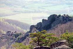
Big Devils Stairs |
5.5/1900 |
4 |
1:15 |
bushwhack up rocky gorge |
|
Little Devils Stairs |
5.5/1780 -
13/3200 |
4 |
1:00 |
rocky gorge |
|
Jeremys Run |
12/2600 |
4 |
1:20 |
long section of scenic stream |
|
Mount Marshall |
13/1960 |
3 |
1:20 |
views |
|
Overall Run Falls |
9.2/2300 -
10.8/2840 |
3 |
1:25 |
waterfall, stream |
|
Lands Run Falls |
8.5/2000 |
2 |
1:00 |
small falls, views |
| |
|
Shenandoah National Park - Central section
|
| Trail |
Distance |
Rating |
Drive |
Attractions |
|
Old Rag |
7.1/2200 |
5 |
1:25 |
great views, rock scramble |
|
White Oak Canyon |
5.3/1670 -
12/3100 |
5 |
1:35 |
many waterfalls, views |
|
Rose River Loop |
3.7/860 -
6.5/1620 |
3 |
1:40 |
waterfalls, very scenic stream |
|
Rose River |
8.7/1700 -
12.8/2600 |
3 |
1:35 |
bushwhack along river |
|
South River Falls |
4.3/820 -
5.8/1400 |
3 |
1:40 |
impressive waterfall |
|
Robertson Mountain |
5.2/1200 -
10/2800 |
3 |
1:35 |
view, stream |
|
Rapidan Camp |
6.8/1000 -
13.3/1800 |
3 |
1:40 |
historic interest, small falls |
|
Lewis Falls |
3.7/1200 |
2 |
1:40 |
waterfall |
|
Buck Hollow |
6.5/1800 |
2 |
1:00 |
stream |
| |
|
George Washington National Forest
|
| Trail |
Distance |
Rating |
Drive |
Attractions |
|
Big Schloss |
5.8/1400 -
11.8/1800 |
4 |
1:55 |
large rock formation w/great view |
|
Duncan Knob |
3.1/1200 -
12.4/2000 |
3 |
1:35 |
rock scramble w/good view |
|
Little Schloss |
5.5/900 -
14.5/2000 |
3 |
1:55 |
rock formation and views |
|
Signal Knob |
10.6/1600 |
2 |
1:10 |
good view |
|
Veach Gap |
6/1000 |
2 |
1:20 |
view, stream |
|
Kennedy Peak |
9.4/900 |
2 |
1:35 |
view from low tower |
|
Buzzard Rock |
5/700 -
9/1900 |
2 |
1:10 |
views |
| |
|
Other Trails
|
| Trail |
Distance |
Rating |
Drive |
Attractions |
|
Maryland Heights |
6/1300 |
2* |
1:00 |
civil war history, good view |
|
Sugarloaf Mountain |
8.1/1700 |
2 |
0:40 |
very good view |
|
Catoctin Mountain |
8.7/1200 -
10/1760 |
2 |
0:55 |
waterfall, views, rock formations |
|
Prince William Forest Park |
6.1 to 15.6 |
1 |
0:45 |
streams, forest |
|
G. Richard Thompson WMA |
7.2/1300 |
1+ |
0:50 |
(wildflowers) |
|
Cascade Falls |
5.1/400 |
1 |
0:50 |
waterfall, stream, forest |
| |
|
Inside or near the Beltway
|
| Trail |
Distance |
Rating |
Drive |
Attractions |
|
Billy Goat Trail |
4/100 |
4* |
0:20 |
mather gorge, boulder scrambling |
|
Great Falls/Difficult Run |
5 to 7 |
1* |
0:20 |
mather gorge, historic interest |
|
Potomac Heritage Trail |
[up to 10+] |
1 |
0:15 |
river, streams (wildflowers) |
|
Manassas Battlefield Park |
[up to 10+] |
1* |
0:20 |
civil war history |
|
Bull Run/Occoquan Trail |
[up to 18] |
1+ |
0:20 |
stream (wildflowers) |
|
Fairfax Cross-County Trail |
[up to 38] |
1 |
0:10 |
streams |
|
Washington, DC - Trails |
you decide |
1* |
0:15 |
streams, historic sites |
|
Washington, DC - Walks |
you decide |
* |
0:15 |
monuments, museums, etc. |
| |